1980’s Archaeological Excavations.
he text for this post is transcribed from two pamphlets that where produced at the time of the 1980s digs at Castle Hill, to aid public understanding of the work that was being carried out by the archaeologists from Liverpool.
Pamphlet #1
Having received permission from the Department of the Environment to excavate a scheduled ancient monument, a North West Archaeological Trust Community Programme is now in the process of investigating an earthwork at Castle Hill, Newton-le-Willows. Although this mound is a recognisable landmark and still stands over 3m high, it is suffering from erosion.
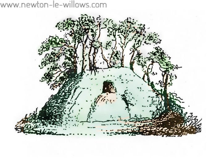
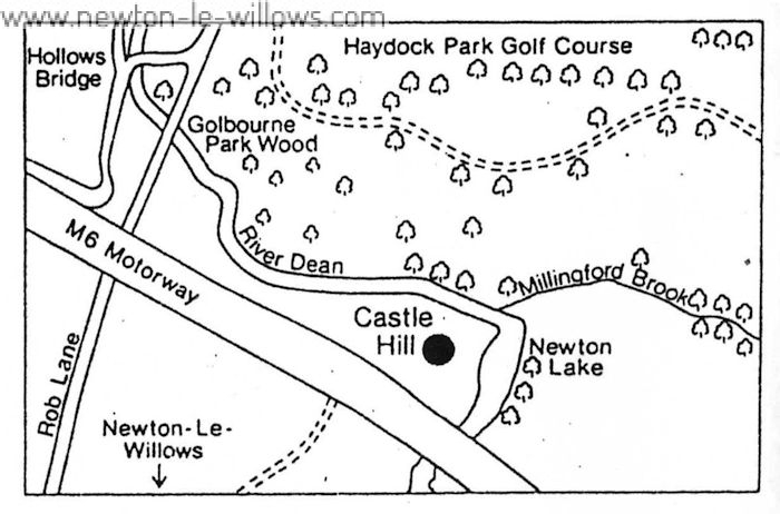
The M6 motorway lies a few metres from the site, and its construction may have removed archaeological evidence of outbuildings associated with the site.
The site was partially excavated in the 19th century by a group of Victorian gentlemen who had mistakenly thought it to be an ancient Bronze Age burial mound.
A series of horizontal and vertical shafts were cut into the mound. Finds included the existence of a small chamber, along with a fragment of white pottery, and evidence of timbers found beneath the mound. After this excavation the shafts were backfilled, and these areas are now subject to more serious erosion.
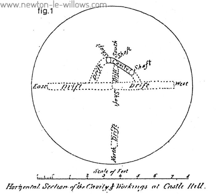
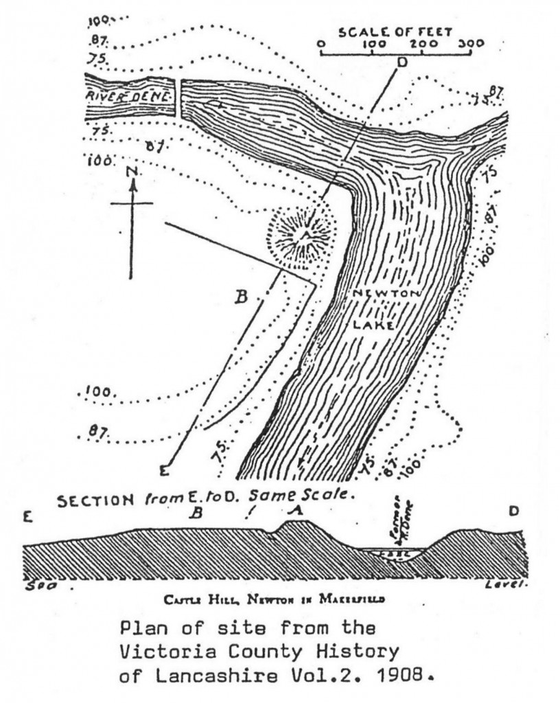
The aims of the current excavation are to re-open the 19th century shafts for the purpose of establishing the exact location and extent of the 19th century excavations, and earlier land surface. It is hoped that indications will be found as to the method of construction and date of the mound, and the implications of timbers and the chamber found in the 19th century.
A section 14m by 5m will also be cut across a ditch identified in the 1843 excavation to establish its original depth, date of construction and relationship with the mound. Further survey and excavation outside the scheduled area will hopefully establish the existence of ancillary features related to the mound. Although excavation and survey will only occupy 10-12 weeks, it will be incorporated into a programme of research which includes archaeological work at two other medieval moated sites in the county.
The work is being carried out by an MSC Community Programme sponsored by the NWAT. Current work includes documentary research in conjunction with the excavations.
Documentary evidence can provide some idea of the history of Castle Hill, although this often consists of tantalising scraps of information because few documents survive to the present day. By considering this evidence with information from excavations a fuller picture can emerge of life and events in the past.
The earliest reference to Newton is in the Domesday Survey of 1086 which lists Newton Hundred as belonging to the king at the time of the Norman Conquest (a hundred was an administrative district rather similar to a modern district). Individual manors within the hundred were held by freeman.
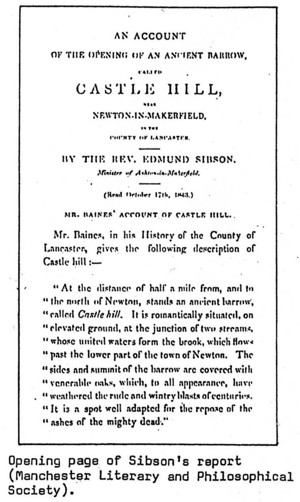
In 1190 the lands at Newton which include Castle Hill were granted to Robert Banastre by Henry II in exchange for the manor of Prestatyn in North Wales.
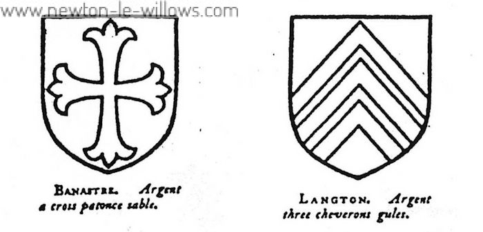
By the mid-14th century the site had been abandoned; this is known because Robert de Langton was granted a license to crenellate a new manor house, probably near Newton Hall, in 1341.
NORTH WEST ARCHAEOLOGICAL TRUST, 19 Abercromby Square, Liverpool, L69 3BX.
Pamphlet #2
Archaeological Excavations at CASTLE HILL Newton-le-Willows
Where and what is Castle Hill?
Castle Hill lies in Newton-le-Willows, fifteen miles east of Liverpool. It is an artificial (man-made) earthwork or mound, occupying a commanding site, within an elbow formed by the deep-cut valley of the River Dene.
The M6 motorway lies a few metres away from the site and its construction may have removed archaeological evidence of past activity associated with the site. The mound is shaped rather like a pudding, almost circular, with a flat top, and with small trees and bushes growing on the summit.
Who is digging?
A North West Archaeological Trust H.S.C. Community Programme, having received permission from the Department of the Environment, are now in the processs of excavating this scheduled monument.
Where, and what are they digging for?
The NWAT are excavating or “digging”, the actual mound and part of the area around it. A trench 14m x 5m will be cut across a ditch identified in the 18A3 excavations, to establish its original depth, date of construction, and relationship with the mound. Parts of the mound excavated in 19th century will be examined againto reinterpret the evidence and to find the original land surface. From this it is hoped to establish some evidence for the date and construction method of the mound, and possible earlier use of the site.
Further survey and excavation outside the scheduled area will hopefully establish the existence of ancillary features related to the mound. It is possible that there was a wooden watch-tower on top of the mound, associated with a defended homestead nearby. There may also have been a bridge across the stream at the bottom of the marshland, or across the ditch, and possibly other buildings in the area around the mound.
Although excavation and survey will only occupy ten to twelve weeks, it will be incorporated into a programme of research which includes archaeological work at two medieval moated sites in the county, and it will take much longer to analyse the information from the digs.
History of Castle Hill.
Documentary evidence can provide some idea of the history of Castle Hill, although this often consists of tantalising scraps of information because few documents survive to the present day.
By considering this evidence with information from excavations a fuller picture can emerge of life and events in the past. The earliest reference to Newton is in the Domesday Survey of 1086, which lists Newton Hundred as belonging to the King at the time of the Norman Conquest (a hundred was an administrative district rather similar to a modern District). Individual manors within the hundred were held by freemen.
Castle Hill was probably the administrative centre of the hundred and as such was a site of local importance. There is a gap in the documentary evidence until 1190, when lands at Newton including Castle Hill, were granted to Robert Banastre by Henry II, apparently in exchange for the manor of Prestatyn in North Wales.
By 12S7, Robert’s grandson (also called Robert Banastre) was granted permission to hold a market at Newton every Thursday, and a three day fair on 29th-31st of October every year. A case heard in the King’s court in 1268 shows that Robert was accusing nine others of destroying his fish-pond and imprisoning his wife and sons. Although no details survive about this interesting event, it does show that fish were kept for food in 13th century in Newton.
There is no surviving documentary evidence for the construction of the mound, which may have been built for defensive purposes, although it is rare for these to have been built after 1300. Several such sites were established at the head of hundreds in the Norman period, probably because of disputes between barons. Castle Hill may follow the same pattern which would date it to somewhere between 1050 and 1300. Archaeological excavation may produce a more accurate date.
It is certain by 1341 Castle Hill vas abandoned as Robert de Langton obtained permission to fortify a new manor house, probably near Newton Hall, at this date.
A survey of lands in 1465 provides the first reference to Castle Hill itself by mentioning a field of that name. It also records an “ancient ditch” around part of the field, which may support the idea that Castle Hill was a defensive structure.’
19th century excavations.
The interior of the mound was partly excavated in 1843 by a group of local gentlemen. An account of the excavation was published by the local vicar, the Rev. Edmund Sibson.
The methods used 150 years ago were very different from the archaeology which is seen on the site to day. Several local colliery workers were employed to dig a series of shafts into the top and sides of the mound. The Rev. Sibson and his companions then explored the results.
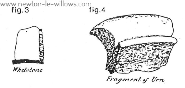
A curved chamber 7m long and 60cm high, and patches of burnt clay and charcoal were found. Objects included a piece of white pottery, a whetstone (for sharpening tools) and an acorn. The excavators were convinced that the mound was a prehistoric burial barrow and it seems that conclusions were made, in Sibson1s report, which extended beyond any evidence found. Archaeologists now realise that valuable information is destroyed by excavation and can never be replaced. Detailed records are kept, and the site is interpreted according to what is found, rather than what we would like to findl The Rev. Sibson imagined pilgrims who “knelt, and wept at the top of this barrow and struck their foreheads on this sacred ridge”. Although this is nowhere near the truth it is an interesting example of the development of archaeological thinking over the last 150 years.
How do archaeologists dig?
Archaeology is the study of people and how they lived in the past, based on what remains are left behind. It is the task of the archaeologist to uncover remains and build up evidence which can be studied in order to tell us how people lived in the past. Often archaeology involves excavation. This means uncovering an area of ground which archaeologists think may hold evidence of how people lived in the past.
Excavation has the major disadvantage of destroying evidence as it proceeds. Having uncovered part of a trench, further evidence can only be gained by digging deeper, which unavoidably destroys all the evidence from the upper layers. It is very important that careful and precise records are made at every stage of an excavation so as to enable as many people as possible to interpret the evidence accurately.
A basic principle of excavation is “stratigraphy”. Soil builds up gradually as time passes, and forms different layers or “strata”. Except where disturbed, lower layers must be from earlier time than those above. It is rather like an empty dustbin in which rubbish is deposited day by day. The oldest rubbish will be at the bottom of the dustbin and the latest at the top. Using this idea, archaeologists can identify the sequence of events and interpret then in order.
Once a site has been chosen for excavation, it is surveyed, to give the height of the site above sea level and its exact position within the national map grid. The position of the trenches is decided, and marked out on the ground, with wooden grid pegs, which provide an accurate framework for drawing the trench during excavation.
Long grass and undergrowth are cleared with a scythe and excavation can begin. The grass is. removed with a spade. Any rubble etc of no archaeological value which may lie
under the grass is removed with mattocks and pickaxes. Archaeological layers are then carefully removed by scraping with a trowel layer by . layer. Any finds are
placed in a finds tray which is labelled with the context (or layer) number in which the object was discovered. Loose soil is put into buckets which are emptied into wheelbarrows. The barrow loads of earth are tipped onto the spoil heap. Once a layer has been removed by trowelling it is necessary to make a precise and complete record of it before any, more digging takes place.
Detailed information on the layers is written out on recording forms called ‘context sheets’, where the site, colour, texture and type of features the layer is made up of, are recorded. Drawings or plans will also be made of the layer (using a theodolite or surveyor’s level and measuring staff the individual spot heights of the layer can be recorded on the drawing). The most common way of drawing a layer accurately is by using a planning frame.
First, a line is made by stretching a measuring tape across the trench between two corresponding grid pegs.
The planning frame is laid on the ground so that it corresponds exactly with the divisions on the tape. This creates a frame within which individual features can be plotted, directly and accurately onto graph paper at a consistent scale, usually 1:20. Points are plotted on graph paper outlining the features contained by the layer. The drawing is completed by simply joining up the points like a dot-to-dot puzzle.
Next a photograph is taken of the layer.
Photographs do not in themselves contain enough information to make plans and drawings unnecessary, but they help by giving a continuous record of an excavation.
The whole process, from trowelling away a layer to photographing it is a cycle which occurs many times during an excavation, amassing a great deal of information which is used to understand the site. When the excavation arrives at natural earth, that is, soil or rock which is undisturbed by man and so is of no archaeological value, the excavation is complete.
All there is left to do is fill in the excavated trenches with soil that has been taken out and endeavour to leave the site in better condition than it was found in.
Hopefully as in the case of Castle Hill this will mean saving the mound from any serious erosion in the future.
All the finds and the records of the excavation are then examined and analysed to discover all the possible information about the site’s past. This can take much longer that the excavation itself.
NORTH WEST ARCHAEOLOGICAL TRUST, 19 Abercromby Square, Liverpool, L69 3BX.
The two pamphlets that I have transcribed and the photographs used were given to me by website visitor and local artist Anne Christian, the photos are © Anne Christian, Pamphlet images © NWAT (North West Archaeological Trust), Transcription by Steven Dowd for use at the Newton-le-willows.com history website.


